Outside Sports 418 views 14 clicks Claim this Business♡
×-
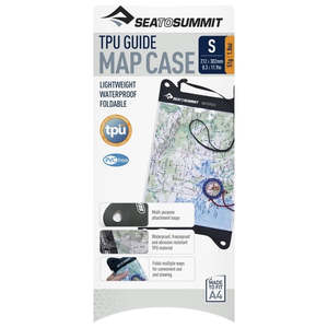 $44.99Sea To Summit TPU Guide Map CaseThe TPU Guide Map Case is made from TPU, with a welded construction and a super strong closure to provide fully waterproof and dustproof performance. The PVC-free TPU material is strong, durable, flexible and resistant to UV and extreme cold—so it can be folded numerous times for pocket storage wi...Buy from Store 0 0
 -
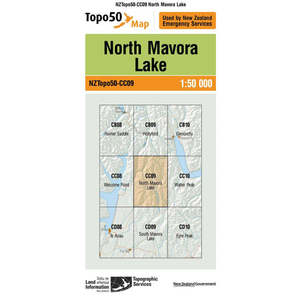 $8.99Topo Map 50 North Mavora Lake CC09Topo50 is the official topographic map series used by New Zealand emergency services. The Topo50 map series provides topographic mapping for the New Zealand mainland and Chatham Islands at 1:50,000 scale.Buy from Store 0 0
 -
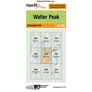 $8.99Topo Map 50 Walter Peak CC10Topo50 is the official topographic map series used by New Zealand emergency services.The Topo50 map series provides topographic mapping for the New Zealand mainland and Chatham Islands at 1:50,000 scale.Buy from Store 0 0
 -
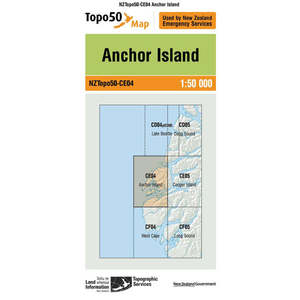 $8.99Topo Map 50 Anchor Island CE04Topo50 is the official topographic map series used by New Zealand emergency services. The Topo50 map series provides topographic mapping for the New Zealand mainland and Chatham Islands at 1:50,000 scale.Buy from Store 0 0
 -
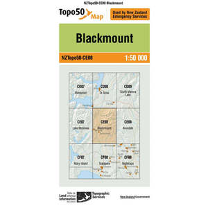 $8.99Topo Map 50 Blackmount CE08Topo 50 is the official topographic map series used by New Zealand emergency services.The Topo 50 map series provides topographic mapping for the New Zealand mainland and Chatham Islands at 1:50,000 scale.Buy from Store 0 0
 -
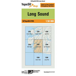 $8.99Topo Map 50 Long Sound CF05Topo50 is the official topographic map series used by New Zealand emergency services. The Topo50 map series provides topographic mapping for the New Zealand mainland and Chatham Islands at 1:50,000 scale.Buy from Store 0 0
 -
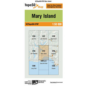 $8.99Topo Map 50 Mary Island CF07Topo50 is the official topographic map series used by New Zealand emergency services.The Topo50 map series provides topographic mapping for the New Zealand mainland and Chatham Islands at 1:50,000 scale.Buy from Store 0 0
 -
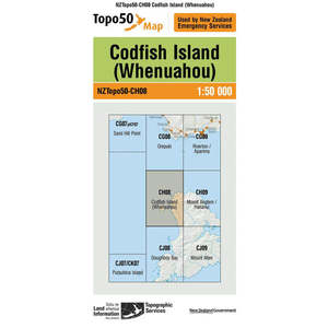 $8.99Topo Map 50 Codfish Island CH08Topo50 is the official topographic map series used by New Zealand emergency services. The Topo50 map series provides topographic mapping for the New Zealand mainland and Chatham Islands at 1:50,000 scale.Buy from Store 0 0
 -
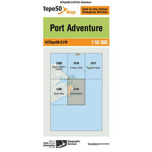 $8.99Topo Map 50 Port Adventure CJ10Topo50 is the official topographic map series used by New Zealand emergency services. The Topo50 map series provides topographic mapping for the New Zealand mainland and Chatham Islands at 1:50,000 scale.Buy from Store 0 0
 -
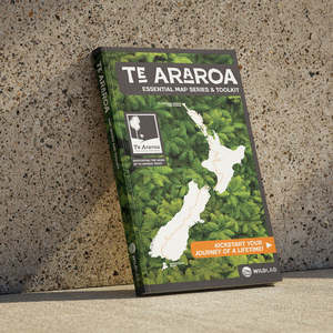 $57.99WildLab Te Araroa Map Series and ToolkitTHEY'VE ARRIVED! Get in quick to secure your advance copy and be among the first to explore Te Araroa in a whole new way.Te Araroa is more than a line on a map — it’s a living journey through landscapes, communities, and stories across Aotearoa. This new six-map series brings the whole trail tog...Buy from Store 0 0
 -
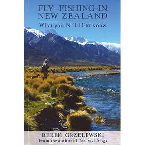 $39.99Fly Fishing In NZ What You Need To KnowFly-Fishing in New ZealandWhat you NEED to KnowBy Derek GrzelewskiNew Zealand has a reputation of having the best fly-fishing for trout in the world - but also some of the hardest and most challenging. As a professional fly-fishing guide, Derek Grzelewski, author of The Trout Trilogy, shares his exp...Buy from Store 0 0
 -
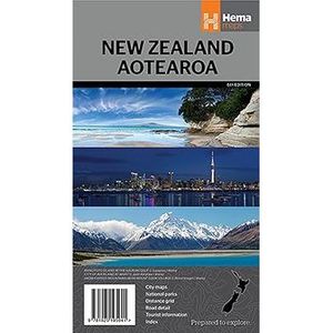 $14.99New Zealand Aotearoa Map (1: 1,600,000) (6th edition 2016)Folded, indexed road and tourist map of New Zealand, showing all major and many minor roads, cities, and towns in detail. Map shows highways, road numbers, distance chart, railways, scenic routes, places of particular interest, places of scenic beauty, national parks, and political boundaries. Rever...Buy from Store 0 0
 -
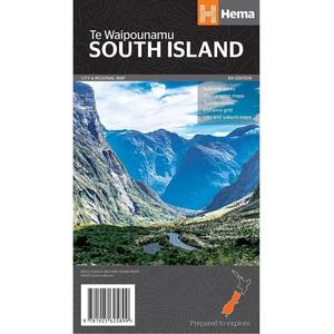 $14.99South Island Folded 8th Edition MapSouth Island New Zealand Map (Te Waipounamu)This regional map of the South Island of New Zealand (Te Waipounamu) is at a scale of 1:1,000,000 andshows points of interests, tourist routes, walking tracks and national parks for touring the island.On the reverse side are handy city maps of Christchurch...Buy from Store 0 0
 -
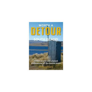 $39.99Worth a Detour South IslandWorth A Detour South Island hidden places and unusual destinations off the beaten trackBy: Peter JanssenTravel writer Peter Janssen shares unique and sublime experiences, often overlooked by visitors heading to popular attractions. Discover hidden sights and adventures, and uncover the lesser-known...Buy from Store 0 0
 -
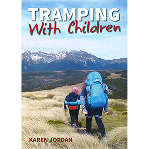 $34.99Tramping With Children BookTramping with ChildrenBy Karen JordanIf you are interested in taking children tramping, or are a beginner tramper yourself, then Tramping with Children is a great book to read before you lace up your boots.Part One features useful hints and information for tramping with children, including planning...Buy from Store 0 0
 -
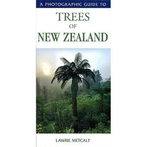 $27.99Photographic Guide to Trees of NZPhotographic Guide to Trees ofBy Lawrie MetcalfA Photographic Guide to Trees of New Zealand, written and photographed by Lawrie Metcalf, and A Photographic Guide to Birds of New Zealand, written and photographed by Geoff Moon. In A Photographic Guide to Trees of New Zealand, fact-filled s highlighti...Buy from Store 0 0
 -
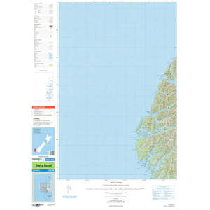 $8.99Topo Map 250 Dusky SoundThis topo 250 map from North Zealand's Department of Survey and Land Information provides topographic details for Dusky Sound. This map is the same map that's used by New Zealand Emergency Services.Topo map 1:250000 scaleBuy from Store 0 0
 -
-
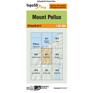 $8.99Topo Map 50 Mount Pollux BZ11Topo50 is the official topographic map series used by New Zealand emergency services.The Topo50 map series provides topographic mapping for the New Zealand mainland and Chatham Islands at 1:50,000 scale.Buy from Store 0 0
 -
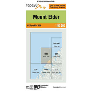 $8.99Topo Map 50 Mount Elder CB06Topo50 is the official topographic map series used by New Zealand emergency services. The Topo50 map series provides topographic mapping for the New Zealand mainland and Chatham Islands at 1:50,000 scale.Buy from Store 0 0
 -
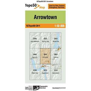 $8.99Topo Map 50 Arrowtown CB11Topo50 is the official topographic map series used by New Zealand emergency services. The Topo50 map series provides topographic mapping for the New Zealand mainland and Chatham Islands at 1:50,000 scale.Buy from Store 0 0
 -
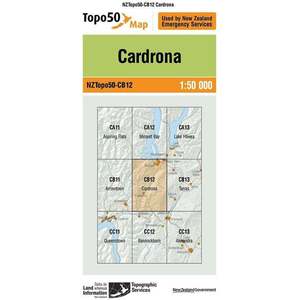 $8.99Topo Map 50 Cardrona CB12The a detailed map specifically tailored for the Cardrona area in New Zealand. It offers comprehensive coverage, featuring contour lines, elevation data, trails, roads, and key geographical landmarks. Ideal for outdoor enthusiasts and adventurers, this map provides precise navigation details, aiding...Buy from Store 0 0
 -
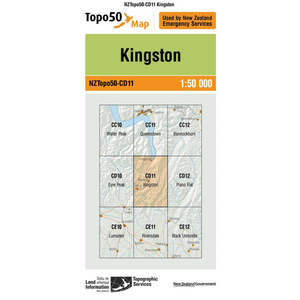 $8.99Topo Map 50 Kingston CD11The a highly detailed topographic map at a scale of 1:50,000, covering the Kingston region. It includes essential cartographic elements such as contour lines, elevation, water features, vegetation, roads, and trails. Ideal for outdoor enthusiasts and adventurers, this map provides accurate informati...Buy from Store 0 0
 -
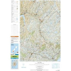
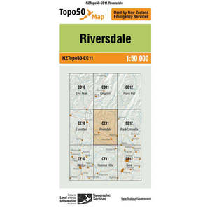 $8.99Topo Map 50 Riversdale CE11Topo50 is the official topographic map series used by New Zealand emergency services. The Topo50 map series provides topographic mapping for the New Zealand mainland and Chatham Islands at 1:50,000 scale.Buy from Store 0 0
×